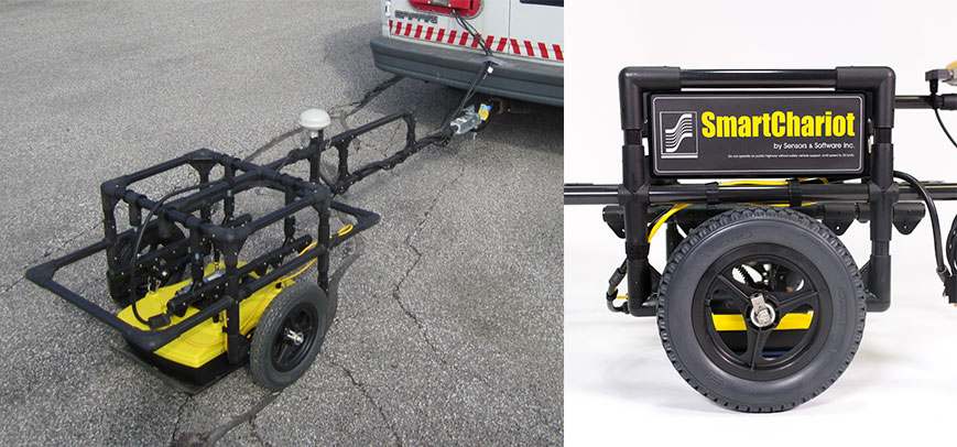
Streamline your Data Collection with SmartChariot
Our customers are always looking for ways to simplify GPR data collection and increase productivity in the field. This is especially true when large areas need to be surveyed; covering these areas with a GPR cart or hand-towed configuration is usually too time-consuming or simply not feasible. To meet this need, Sensors & Software designed the SmartChariot configuration for Noggin GPRs and pulseEKKO PRO transducers. The SmartChariot attaches to any vehicle with a trailer hitch and accommodates the Noggin 250, 500 or 1000 systems and pulseEKKO 500 and 1000 MHz transducers.
As with all of the Noggin configurations, the SmartChariot is compatible with the Noggin data acquisition on the Digital Video Logger (DVL). The SmartChariot has an integrated odometer ensuring regular triggering of the GPR at user defined intervals and provides a mount to attach a GPS for georeferenced data. The non-metallic SmartChariot structure minimizes undesirable transport platform interference and provides mechanical adjustment to allow the GPR to ride in very close proximity to the ground, maximizing penetration, resolution and data quality. The high density polymer skid-plate protects the system during use.
The most common use of the SmartChariot is for road and bridge inspection. Figure 1 shows an example of data collected with a SmartChariot processed into a deterioration index map to assess the condition of the bridge deck.
 Figure 1: GPR signal attenuation map plotted in Google Earth showing bridge deck condition assessment.
The SmartChariot can also be used to detect utilities and other subsurface features on roads, sidewalks, parking lots and other large, smooth open areas. Figure 2 shows road data collected with the Noggin 250 SmartChariot configuration. The data clearly shows the classic hyperbolic response of a buried pipe, plus it delineates the road bed structure, and the in-filled trench. If features of interest are smaller and shallower, the Noggin 1000 can be deployed. Figure 3 shows shallow embedded road sensors detected with a Noggin 1000 deployed on a SmartChariot.
Although most commonly towed behind a car or truck, the SmartChariot connects to any standard hitch and can also be deployed on smaller vehicles including golf carts, ATVs, motorcycles or even bicycles. This flexibility allows the SmartChariot to be used for surveys of large open areas, including parking lots, warehouse floors, and open fields such as golf courses and parks.
If you already own a SmartCart, integrating the SmartChariot into your field operations is a logical next step, as it uses the same Noggin or pulseEKKO PRO system, and runs the same DVL data acquisition software. This helps minimize the cost and learning curve, enabling you to quickly offer more service capabilities to your clients. For more challenging applications, SPIDAR based configurations can deploy two GPR units concurrently. Check with our custom system specialists for more details.

Figure 2: Hyperbolic pipe response is clearly visible in the in-filled trench. Construction layering under the asphalt is well defined at shallower depths.

Figure 3: Data collected with the Noggin 1000 SmartChariot showing shallow road sensors and layering.


