
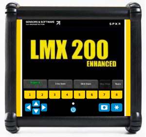
LMX200™
Utility locating GPR system


Utility locating with GPR made simple
The LMX200™ provides designed to deliver deeper subsurface insights and support target confidence to detect traditionally non-locatable subsurface features such as:
- Metal utilities, including pipes and cables
- Non-metallic pipes, including PVC and asbestos cement
- Concrete storm and sewer systems
- Utilities where installed tracer wiring has failed
- Underground storage tanks and drainage tiles
- Septic system components
- Non-utility structures such as vaults, foundation walls and concrete pads
Public utility systems and local governments require that the positions of underground systems are located and marked. This helps in planning projects and avoiding risks and hazards. The LMX200™ builds on the capabilities of the LMX100™ and adds further features to help you locate and map these utilities. It adds the powerful Grid Scan mode and the ability to use an external GNSS to take full advantage of SplitView and MapView. The LMX200™ also allows data export for post-processing, archiving, reference and further mapping capabilities in EKKO_Project™


Visualize, Understand and Report your GPR results with optional EKKO_Project™ PC Software
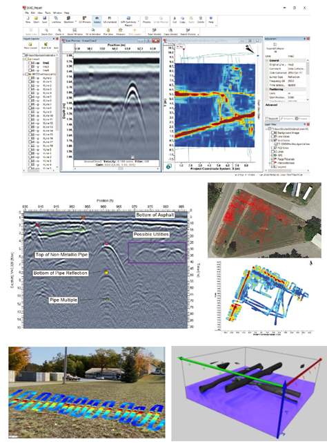
- Organize GPR data, photos and other files as a single project (.GPZ file)
- Easily create PDF GPR summary reports of your findings.
- Add interpretations, photos, audio & video to GPR lines.
- Create depth slices with or without a grid.
Explore the many options for data visualizations and analysis with EKKO_Project software bundles.
Contact Us
Case Studies
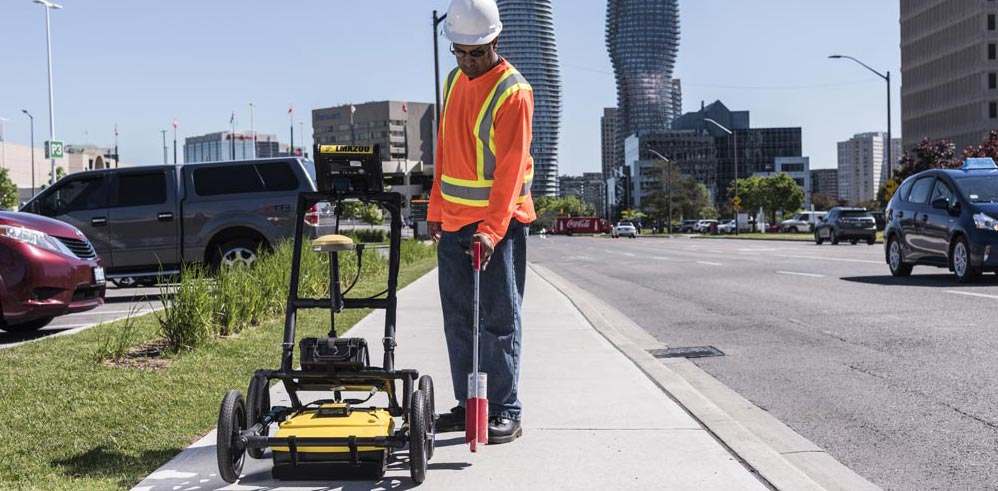
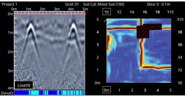
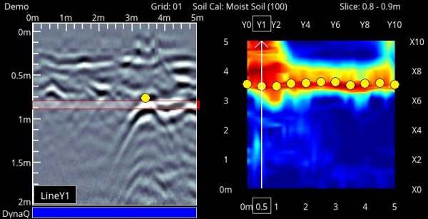
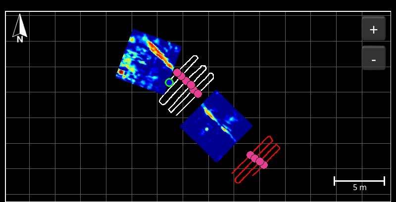
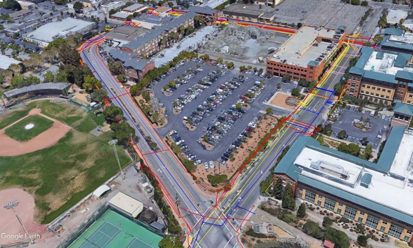
Locating a storm water sewer pipe line
LMX200 GPR was used to locate a storm sewer pipe to ensure successful HDD installation of fiber lines.
Learn more


