Finding historic artifacts hidden underground can be challenging, time consuming and expensive. To focus research and identify potential excavation sites, archaeologists need tools that can non-destructively investigate historic sites and provide information about what may lie buried in the ground.
Ground penetrating radar (GPR) is an effective, non-invasive, and non-destructive technology used to image and map historic sites in archaeological studies worldwide.
Archaeologists employ many tools for historic site investigations, including:
- Ground Penetrating Radar
- Electrical Resistance
- Electromagnetic Conductivity
- Magnetometers
- LIDAR
- Metal Detectors
It is recommended that multiple, non-destructive geophysical techniques are used so data can be correlated to gain a greater understanding of the site. As part of the toolkit, GPR provides the following advantages:
- Enables high-resolution surveys which allow for details to be highlighted and mapped.
- Detects metallic and non-metallic objects, and disturbances in the soil.
- Provides a clear indication of the depth of buried objects.
GPR can provide a map of the site before a shovel is ever put into the ground.
GPR maps offer useful primary survey data to establish locations for excavation, or to identify sensitive areas where cultural remains, such as burial sites, may be located. The information provided from GPR surveys can guide archaeologists to avoid disturbing or destroying the valuable history buried within.
By incorporating GPR into archaeological surveys you can:
- Plan excavation efficiently.
- Excavate with an understanding of the site context.
- Gain knowledge and preserve the site without needing to excavate.
Finding Unmarked Graves and Mapping Cemeteries
Cemetery Survey, USA
NOGGIN® 500 GPR data collected at a cemetery showing burials. The GPR grid is 20 x 20 m, with lines spaced 0.25 m apart. Since the orientation of the burials was known, based on the grave markers, this data was collected in one direction only to cross the burials perpendicularly. Targets start at various depths from 30 cm to 50 cm deep.
Data courtesy of Jarrod Burks, Ohio Valley Archaeology, Inc
Case Study
Unmarked Graves, USA
NOGGIN® 250 GPR was used to locate unmarked burials at an African-American Cemetery. This depth slice shows the lateral extent and a good estimate of the number of burials at the site.
Data courtesy of Mark Howard, NAEVA Geophysics
Tuscaloosa Cemetery, USA
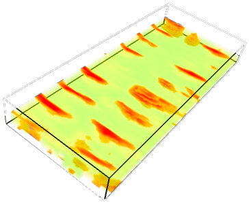
A 3D view of a burials at a cemetery is Tuscaloosa, Alabama, USA, collected with a NOGGIN® 250 GPR system. The coffins have a higher reflectivity than the surrounding soil, making it easy to create a 3D display with the coffins shown as a solid color while the weaker soil reflections are translucent or even invisible.
Viking Grave, Norway
The objective of this project was to map an area with a suspected Viking settlement to look for patterns consistent with ancient human habitation.
A 50×50 m grid was collected with a NOGGIN® 500 system. The depth slice animation shows a circular pattern, interpreted as being a Viking grave.
Data courtesy of Lars Winroth, Modern Arkeologi
Excavated Viking grave, thought to be similar to the grave mapped in the data above.
Buried historic buildings, ancient ruins, structures & settlements
Roman Fortress Structures in Carnuntum, Austria
Carnuntum was a Roman Legionary Fortress and a provincial capital city with a population of 50,000 people. GPR was used to map an area in Carnuntum, Austria with no ruins visible on the surface. A GPR grid was collected with a NOGGIN® 500 SmartCart over an area of 160 x 250 meters with a line spacing of 0.5 m without disturbing the site.
The depth slice animation shows 31 depth slices from 0.0 m to 3.0 m depth in 0.1 m intervals, revealing buried foundations, walls, and other details of a buried building.
Data courtesy of Archaeo Prospections
Roman Military Camp, Romania
A project in Romania used GPR to map the internal layout of a Roman castrum (military camp). A NOGGIN® 500 in the SmartTow configuration was used to collect multiple grids that were subsequently merged into one large grid for data processing with the EKKO_Project™ software.
The animation shows depth slices from 0 to 2 m deep in 0.1 m intervals, revealing the internal layout of the camp, including several phases of construction.
Data courtesy of Andre Gonciar, Bioarch Canada
Brickworks Building Foundations, USA
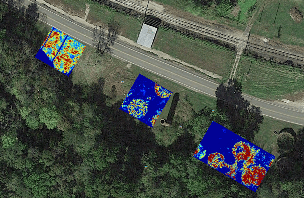
Archaeology students used a NOGGIN® 500 GPR and collected several grids at a historic brickworks site; the purpose of the survey was to look for evidence of demolished structures.
Depth Slice images displayed on Google Earth™ shows the foundations of structures from the 18th century.
Data courtesy of Jarrod Burks, Ohio Valley Archaeology, Inc.
Military History
The Lost Squadron, Greenland
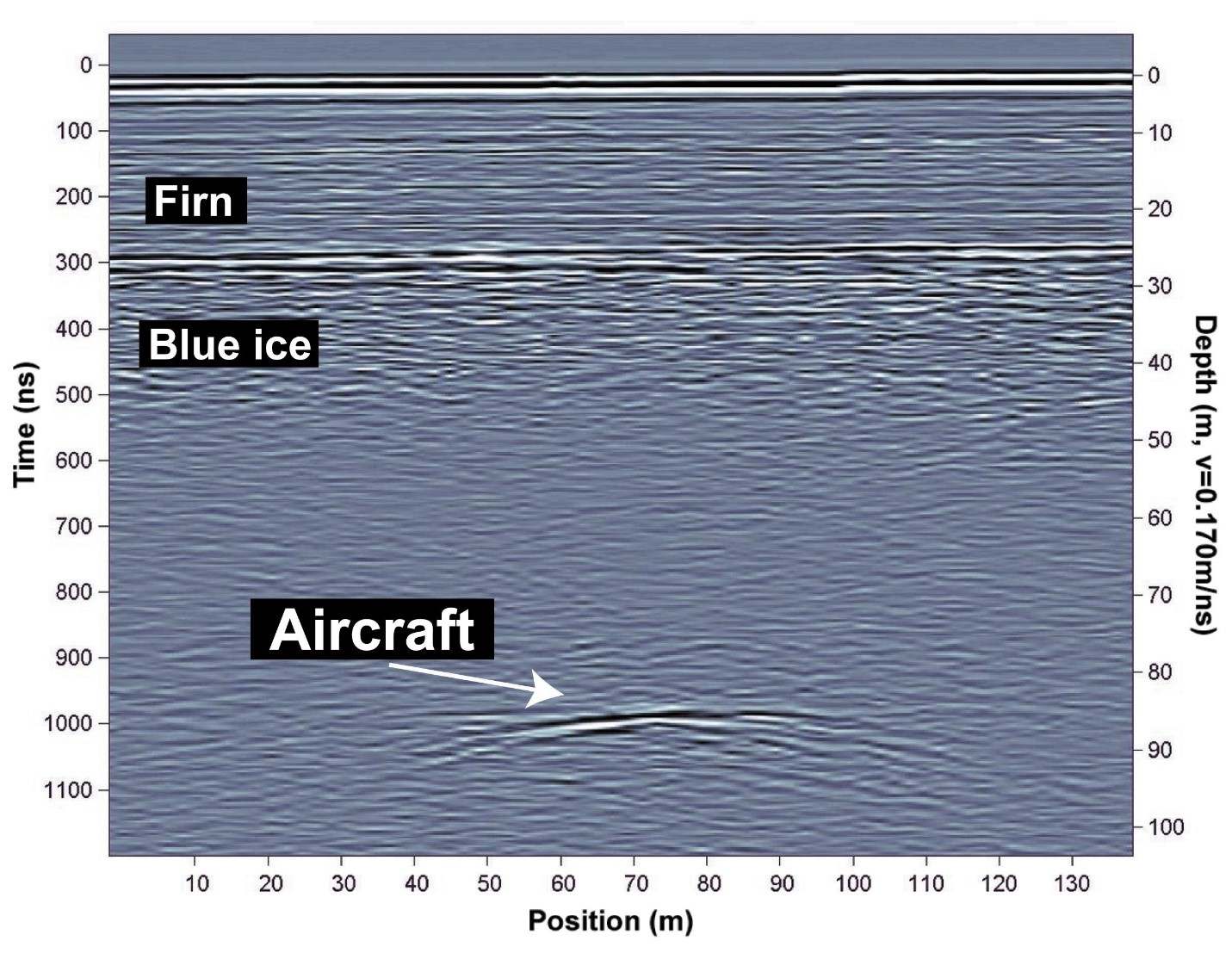
A pulseEKKO® 50 MHz GPR was used to search for a squadron of WWII planes that had been forced to make emergency landings in Greenland during the war. In 1992, 50 years after the planes were lost, GPR line surveys were collected and successfully located one of the missing planes. This GPR cross-section shows a strong reflection at 85 metres below the surface, interpreted as one of the aircraft.
After a long and labor-intensive excavation into the ice, the well-preserved plane, now known as “Glacier Girl”, was discovered.
Lost Cannons of West Point, USA
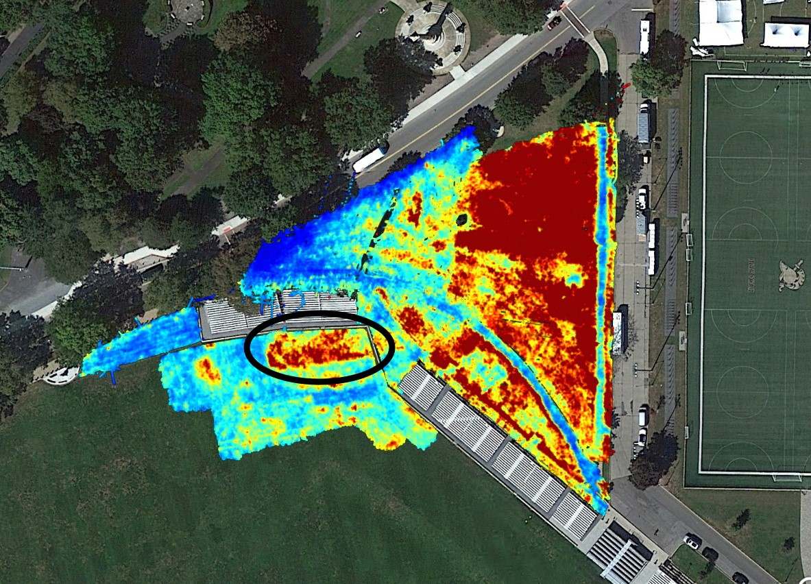
Geophysics students at West Point Military Academy have used a pulseEKKO® 1000 and a LMX200 systems over a span of 25 years to gradually map the campus. One of the goals was to find a cannon battery complex, buried in place in the 1930s, somewhere under a grass field used for marching parades. They think that they found it (black circle) although the location has not been excavated to confirm the interpretation.
Case Study
Sensors & Software GPR Systems
Advantages
- Easy to use, flexible operation
- Ground-coupled GPR to provide the best quality, deepest penetration and highest resolution data possible
- Intuitive and powerful processing software to efficiently analyse and report results
- Industry recognized GPR expertise and support to help you maximize your GPR returns
- We offer a selection of systems for Archaeological applications, so you can choose the one that is best for your needs.
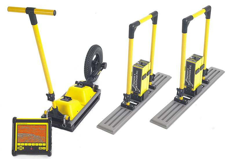
The NOGGIN® offers ultimate flexibility. Choose between four different center frequencies and five different configurations to suit your application. NOGGIN® systems also offer custom data acquisition options.
pulseEKKO® GPR systems provide unparalleled performance with a wide-range of frequencies for applications ranging from deep mineral exploration and glaciology to high-resolution geotechnical investigations and concrete imaging.
EKKO_Project™ Visualize – Understand – Report
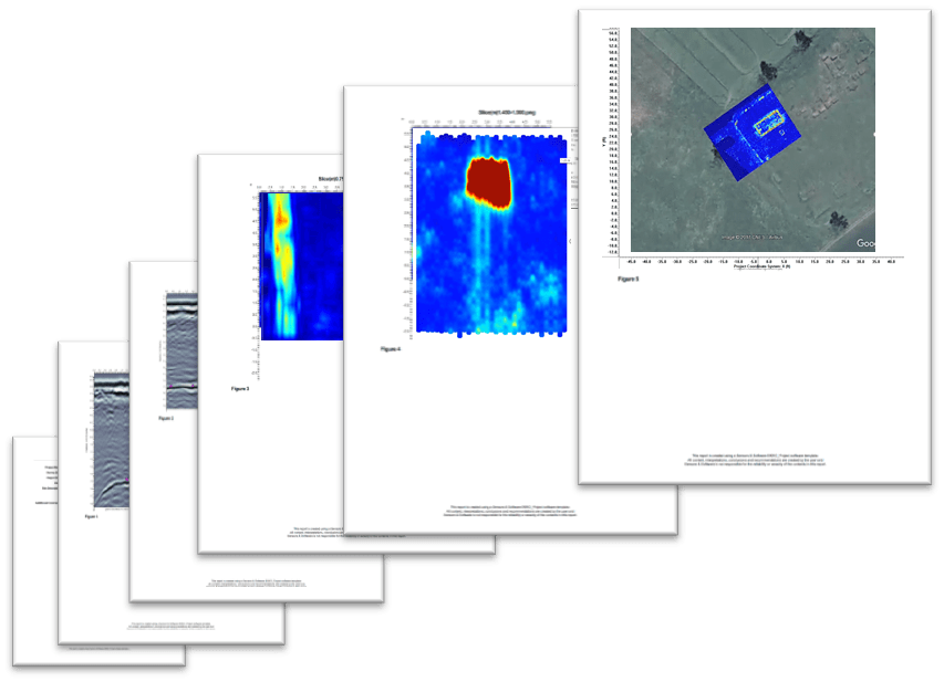
EKKO_Project™ is the all-inclusive software solution for managing, displaying, processing, and interpreting GPR data. EKKO_Project™ allows you to visualize your GPR data from many perspectives, giving you confidence in your findings & providing an intuitive and professional way to share your findings with others.
Learn More


