
NOGGIN®
Adaptable, High-Performance GPR Systems


NOGGIN® GPR systems are used by researchers and practitioners to collect high-quality data for a wide range of subsurface applications in challenging environments worldwide—from the equator to polar regions.
The Noggin platform is highly adaptable, offering multiple deployment configurations (SmartCart ™, SmartTow ™, SmartHandle ™, SmartSled ™, and SmartChariot ™) to support a wide range of terrain and project needs. A broad selection of antenna frequencies — from 100 MHz for deeper, larger targets to 1000 MHz for near-surface detail — allows operators to better tailor the system to their application requirements. With four center frequencies and five standard configurations, NOGGIN systems span the depths and resolutions required for many subsurface investigations. Choose the combination of center frequency and configuration best suited to your application and terrain.
| NOGGIN | ||||||
|---|---|---|---|---|---|---|

|

|

|

|
|||
| Configuration | Applications (right) Terrain (below) |
Geologic mapping, geotechnical applications and deep subsurface utility mapping | SUM/SUE, Underground storage tanks (UST), Drainage systems | Archaeology, Forensics | Pavement, Bridge deck, concrete assessment | |
| SmartCart: Durable, 4-wheeled, folding cart |
Most terrains; flat to moderately rough |  |
 |
 |
 |
|
| SmartTow: Light, compact Tow |
Rough or difficult terrain; steep hills |  |
 |
 |
 |
|
| SmartChariot: Trailer attaches to any vehicle with a hitch |
Large, flat, open areas; roads, parks, golf courses | N/A |  |
 |
 |
|
| SmartHandle: Light, compact pull or push |
Vertical or overhead surfaces; confined spaces | N/A | N/A |  |
 |
|
| SmartSled: Towed behind any vehicle |
Large, open, rough terrains | N/A |  |
 |
 |
|


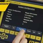
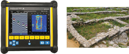
Adjust data collection parameters and view data in the field using the DVL-502 touchscreen digital video logger for Noggin systems. The unit features a high-visibility display, multi-language support, and a USB port for data transfer.
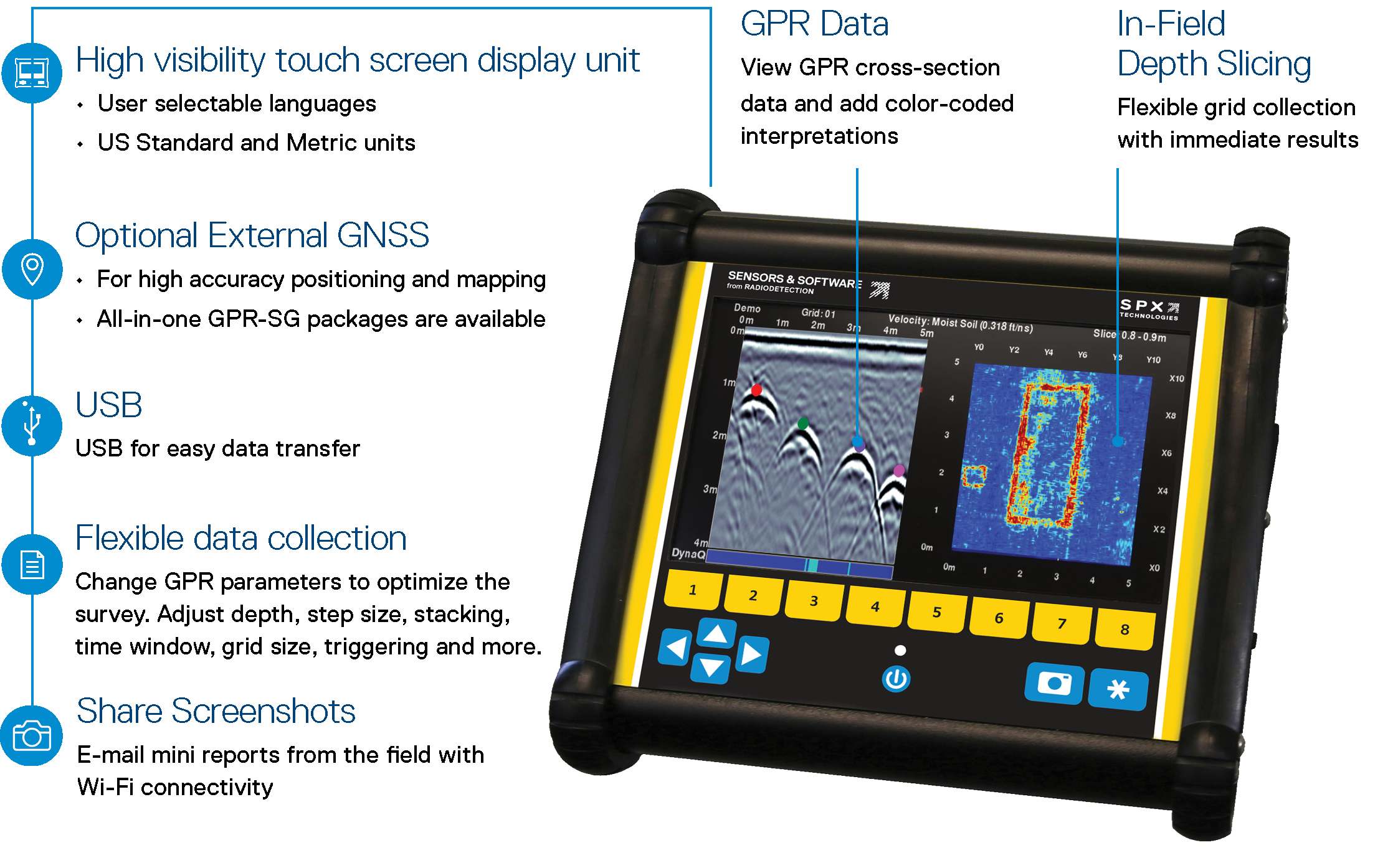
SplitViewTM
Viewing cross section data and the map together helps users interpret subsurface responses in relation to their location. Mark targets by touching them on the cross-section and track their path on the map. The SplitView feature requires an external GNSS.
MapView display
Display a powerful and meaningful bird’s eye view of your site map with survey path, depth slices, field interpretations, flags and collected lines in MapView. The MapView feature requires an external GNSS.
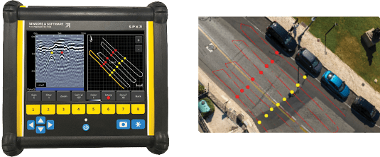
Grid Scans
Provide in‑field depth‑slice views that visualize horizontal layers of the subsurface to support interpretation. Grid scans have flexible collection with different grid sizes, directions and line spacing.
Flexible Trigger Options
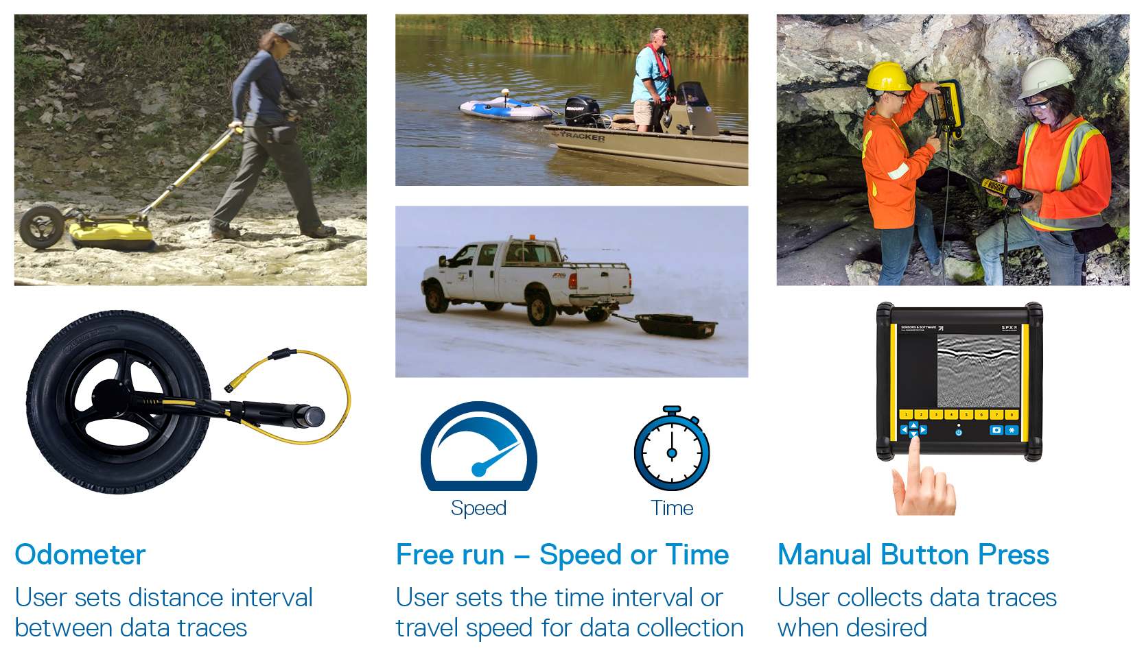
The Noggin DVL offers multiple trigger options to enable GPR data collection in applications requiring different data collection methods – use an odometer to trigger at a set distance, use free run in speed or time when an odometer is not suitable, like on ice or water, or manually press a button to collect data.
After data collection is finished, transfer the data to your computer and organize, edit, process, and plot your GPR data with the optional EKKO_Project™ Software bundles. Visualize your data in seconds – spend your time understanding the data and reporting your findings

Explore the many options for data visualizations and analysis with EKKO_Project software bundles.
Contact Us
Case Studies

Mapping underground fuel storage tanks at a local gas station
Real estate transactions regularly create the need for an environmental site assessment. Confirming the presence or absence of underground storage tanks (USTs) can be a critical factor in contract closing. GPR reflection mapping surveys are commonly used to identify the presence of USTs. The example presented shows five storage tanks plus related pipes discovered at the site of a gasoline station.
Learn more


