
IceMap™
Configurations
Select from the IceMap SmartTow or Base configurations. The fully integrated SmartTow and the Base configuration provide the same friendly user interface for monitoring ice thickness data while driving and integrating coring information for precise ice property calibration. In both cases, data are recorded for export. The IcePicker software exports data to create map displays in GIS platforms or Google Earth as well as tabulated reports to meet regulatory health and safety standards.
IceMap SmartTow
IceMap SmartTow
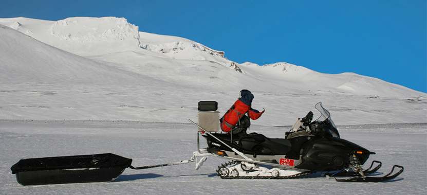
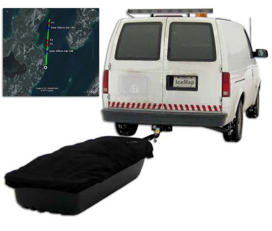 The IceMap SmartTow configuration provides the complete turnkey solution for busy project managers who have to meet ice safety requirements. The SmartTow configuration provides the Noggin GPR sensor, battery, GPS and wireless communications link components in a rugged, environmentally designed field case with a field-tested tow sled. A Toughbook PC mounted in the tow vehicle receives the data from the sensor package over a dedicated wireless communications channel.
The embedded IceMap real-time software on the Toughbook PC provides simple user interface for monitoring ice thickness while surveying as well as entry of coring results to calibrate the ice character and update ice thickness. In addition, overlays of position can be placed onto Google Earth Maps or similar images. Included with the package is the IcePicker software allowing systematic review and editing of ice thickness data. The data can be exported in a variety of forms including CSV spreadsheet files and KMZ files for overlays on Google Earth.
This full-featured solution is essentially ready to go as soon as you are on site. Hook it to your tow vehicle, turn on the power and you are ready to work.
Case Studies
GPR & Arctic Oil Exploration
Arctic oil exploration requires safe transportion of heavy equipment over ice-covered areas. Use of seismic vibrator sources demand that safe ice thickness be assured and quality of data can depend on finding grounded ice. This case study follows the evolution of the IceMap system now widely used for ice thickness mapping.
Learn moreLeasing Options Now Available!
Contact us today to learn how you can get unbeatable lease options on our full range of Ground Penetrating Radar equipment with low monthly payments!


