round Penetrating Radar (GPR) is an important tool for research and teaching in many professional applications, including geological stratigraphy, mineral exploration, environmental assessment, agriculture, archaeology, infrastructure, and more.
Sensors & Software is focused on bringing value and innovation to your projects by providing the most advanced instrumentation and integrated software to allow you to see beyond the surface.

Our academic support program provides access to:
- Free teaching aids
- GPR equipment for research and field schools
- Talks from GPR specialists
- Equipment demonstrations
- Software lab licenses
- Webinars and training
- Reduced rates for courses on SensoftU
Sensors & Software has worked with educational facilities for decades to teach the science of GPR, illustrate the practical applications of GPR and increase research using GPR.
Enhance your research and course curriculum with GPR
Sensors & Software GPR systems are wonderful teaching tools for university labs and field schools because they are simple to use and provide students with a full experience from survey design, data acquisition, data processing, data visualization, data analysis and final reporting.
Leading researchers worldwide rely on our GPR products due to their unparalleled data quality and ability to withstand the most demanding field conditions.


")


GPR solutions for a wide range of applications
EARTH SCIENCE

- Profile geological stratigraphy and bedrock surface
- Characterize soil conditions
- Improve mine safety and guide resource development
ARCHAEOLOGY

- Search for artifacts and tombs
- Map foundations of ancient structures
- Find graves and burials
GLACIOLOGY, SNOW & ICE

- Measure ice thickness and snow depth
- Perform glaciological research
INFRASTRUCTURE

- Assess concrete structures for deterioration
- Measure pavement characteristics
- Locate metallic & non-metallic utilities
ENVIRONMENTAL

- Detect sinkholes and USTs
- Conduct bathymetry and sub-bottom profiling
- Map tree roots and drainage tiles
MILITARY AND LAW ENFORCEMENT

- Detect UXO and IEDs
- Aid forensic investigations
- Locate clandestine graves and tunnels
Featured GPR systems for research and teaching
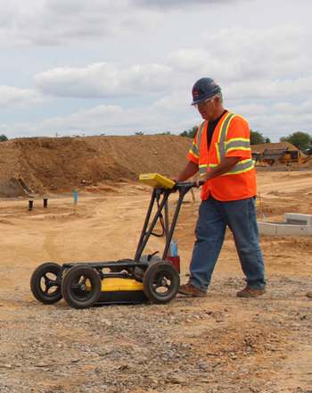
NOGGIN® : Adaptable, high-performance GPR
- Available in 4 center frequencies; from 100 to 1000 MHz
- Easily switch between 4 configurations to collect data in any terrain
- Provides flexible data collection settings to optimize GPR surveys

pulseEKKO® : For the GPR Professional
- Offers the widest range of frequencies – from 12.5 to 1000 MHz
- Bistatic antennas allow for variable antenna separations for advanced survey methods – ideal for CMP, WARR, multi-fold and transillumination
- Ergonomic deployment platforms allow for rapid system reconfiguration

Data visualization
- EKKO_Project™ Software: Intuitive software to manage, display, process & interpret GPR data
- DVL 500 Display Unit: High-resolution touchscreen display with in-field depth slicing, color interpretations and MapView