Many areas of the world, especially land that formed in tropical parts of the world, are underlain by limestone (Figure 1). Limestone is a carbonate sedimentary rock that often consists of the calcium carbonate bodies of trillions of sea creatures, like coral and shells, cemented together to form rock.

Calcium carbonate is water soluble which means that it dissolves in water; not a high level of solubility like salt, but enough that, as water moves through limestone over hundreds or thousands of years, the limestone rock can slowly dissolve, and cavities form inside it. For areas with limestone bedrock, like Florida in the USA, this can cause significant problems when humans build a structure on the surface. News reports show us the results: sinkholes suddenly opening and swallowing buildings, roads, cars and tragically, even people.
GPR has been successfully used for finding underground cavities, both large and small, for decades. The spectrum goes from using high center frequency (1000 MHz) GPRs to find voids a few inches deep under slab-on-grade concrete in warehouses and factories, to using medium center frequencies (200 to 500 MHz) for finding larger voids under roads and runways, and also, to using low center frequency GPRs (12.5 to 100 MHz) for finding large caves for geotechnical surveys and geological research. In all cases, the physics is the same; the transition from material such as rock, concrete or asphalt to the air or water in the void results in a very highly reflective boundary for GPR signals to reflect from.
This case study features a GPR survey collected on a Caribbean island where a large electrical generating station was to be built. Before the start of the project, geotechnical engineers wanted to find any cavities that could disrupt the construction. Forrest Environmental of Virginia, USA, was contracted to survey a site with a pulseEKKO® system using 100 MHz center frequency antennas and the Ultra Receiver. The site had been flattened enough to allow the data to be quickly collected using a SmartCart configuration (Figure 2). The system included a GPS for data positioning.

Several grid surveys were collected at the site. Grid 1 consists of 31 parallel lines, each about 30 m long and spaced 1 m apart. The total line length for the grid is 930 m.
During data collection, a strong, spatially limited reflector plus many smaller ones were visible on many of the GPR grid lines, suspected to be the top of cavities (Figure 3).

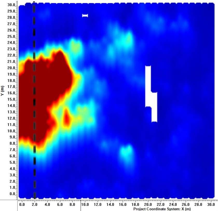
After the grid GPR data collection was finished, the data were transferred to a computer and the SliceView module, part of the EKKO_Project™ GPR analysis software, was used to process the grid data into depth slices; each slice is 25 cm thick, the default thickness for 100 MHz center frequency data. Slicing downward through the data, the strong reflector spans a well-defined area, at a depth of approximately 2.25 m, increasing the confidence that the reflector was from the top of a cavity (Figure 4).

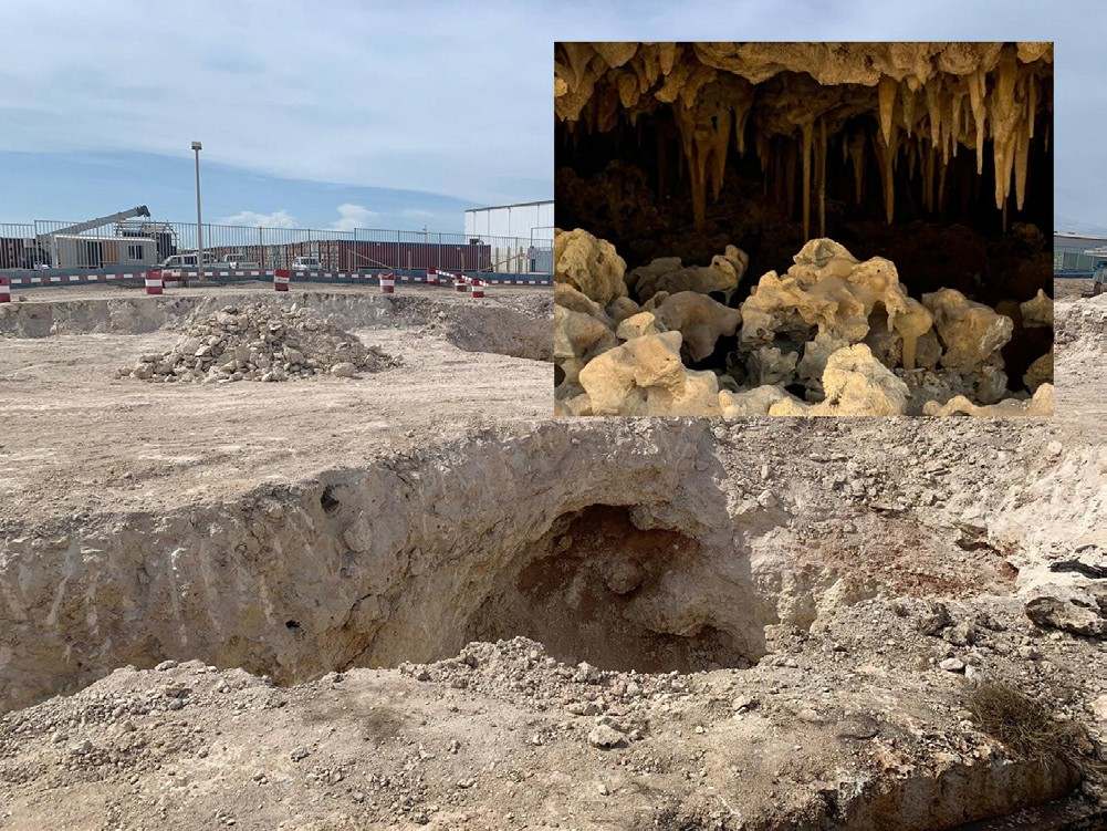
Based on the GPR maps, the project geotechnical engineers decided to excavate to confirm that the strong reflector was a cavity (Figure 5).

As a result of the successful GPR survey to identify cavities before the start of construction, site engineers were able to plan construction around the cavities and fill-in others for the project to go safely ahead, saving time and money in the process by avoiding surprises and costly engineering change-orders.
Story courtesy of Andy Forrest, Forrest Environmental Inc based in Virginia, USA.
Learn More about GPR for Geotechnical


