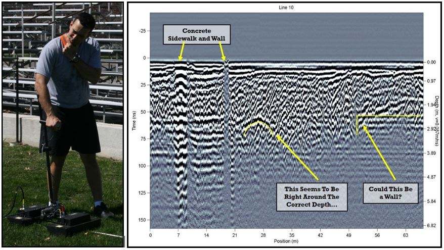
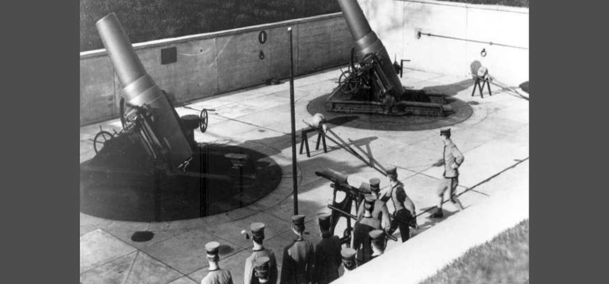
ver the last 25 years, faculty and students at the United States Military Academy at West Point have been using Ground Penetrating Radar (GPR) to locate and characterize archeological features on the campus. The most enticing of these targets is a cannon battery complex, buried in place in the 1930s which is now a grass field used for marching parades. The hunt for those buried cannons over the decades allowed students to learn geophysics and do independent research projects, but never resulted in conclusive evidence to locate the cannons or the battery complex. In a surprising twist, recent attempts to gather more widespread GPR data are leading to a new methodology that may allow the characterization of glacial geomorphology as well. The key seems to be in the visualization of large-scale depth slices.
Early attempts to locate the cannons, in the mid-1990s, used a pulseEKKO® 1000 GPR and both 110 MHz and 225 MHz center frequency antennas. GPR surveys were collected with a very coarse line spacing, 5 to 10 meters apart. Later, aerial photos from the 1920s, predating the burial of the cannons, allowed georeferencing their likely locations. The cannon locations were thought to be directly underneath two sets of permanently mounted metal bleachers built on gravel pads.
The pulseEKKO® 1000 could not fit underneath to collect data and, even if it could, it was thought that the data would not be usable because the metal bleachers would cause severe interference.
A big break came with newer GPR data collection capabilities, quicker and more user-friendly data processing, and the ability to create depth slices from grids of GPR data. In 2008, still using the pulseEKKO® 1000 system, Cadets Katelin Grant and Anton Faustmann collected a grid of data (Figure 1). Early attempts at depth slicing used the EKKO_ Mapper software to process the small, 5-by-5-meter square grid with lines spaced 1 meter apart, but the results were inconclusive and, again, very localized over the probable target location.
In hindsight, one of the primary limitations might have been the bias in designing the GPR surveys to target what was thought to be the exact location of the cannons. The aerial photos and historic maps of the area provided a high confidence level, leading to small, localized surveys directly over the “known” location of the cannon.

Nearly a decade later, in 2017, the hunt for the cannon picked up again using the LMX200™ GPR and the SliceView-Lines module of the EKKO_Project™ software. With the ability to collect GPR data quickly in a “random-walk” pattern and to easily georeference the data for visualization as depth slices, a new strategy for locating the cannon was developed.
Instead of looking for a single cannon directly above the suspected location, it was decided to survey a much larger area, which could reveal the entire footprint of the coastal artillery complex. Cadets Matthew Panner, Yasheika Beckaroo, Nick Dabbelt, and Randy Foristiere each surveyed different areas (Figure 2) and patched the data together to begin revealing evidence of the buried cannon complex (Figure 3).


Using GPR as both a research and teaching tool, a Geography Methods class then used the LMX200™ GPR to collect a patchwork of small grids. As more grids of data are collected over the larger area, the depth slices are starting to reveal broader features under the centuries-old landscaping that are characteristic of glacial geomorphology. For example, the cannon battery was built in a natural depression known as a kettle lake, created by glaciers at the end of the last ice age.
Cadets and faculty hope to continue collecting GPR data over the entire 16-acre area, to finally identify and characterize the archeology and geomorphology hidden in plain sight.
Story courtesy of LTC Mindy Kimball of the US Military Academy at West Point


