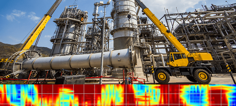
Texas refinery, knowing there was a high risk of voids given the soil conditions in their area, used GPR to scan for voids prior to commencing a construction project where heavy cranes would be used. GPR provided a subsurface map of what risks lay beneath the surface.
Challenges
Throughout the world, there are many geographic regions where soil properties can wreak havoc on engineered structures. When the underlying soil heaves (expands) or subsides (contracts), structural foundations can shift or be damaged. One such geographic area is the gulf coast region in the United States. The soil is subject to extensive subsidence.
To reduce the impact of this, it is standard practice to use concrete piles as part of foundation construction. These piles are driven up to 80 feet into the ground to transfer the load from the soil directly under the foundation (which is more likely to subside) to the deeper soil or bedrock that provide sufficient bearing capacity for the structure.
When renovation projects on existing structures call for the use of heavy equipment, such as cranes, precautions must be taken to ensure the structure can support this machinery. For safety and to minimize structural damage, it is now becoming standard practice in Texas to check for voids and/or weak soil zones beneath the structure before installing heavy machinery.
Using GPR is an effective way to detect voids under concrete foundations. In this case study, the Port Arthur refinery in Texas was planning additional construction on their site. They had a number of areas where they needed to place cranes to aid with the construction. Although there were no visible cracks or evidence of shifting in the foundations, they wanted assurance that they were operating on solid ground before proceeding and hired Tolunay-Wong Engineers, Inc. to perform GPR surveys on the foundations.
Solution
Tolunay-Wong used a NOGGIN® 500 SmartCart® to scan 9 separate areas. On one particular concrete slab, they found a surprising result. During the data collection, they noticed some anomalies in the line data, as shown in Figure 1. They recognized the regular rebar response from the concrete slab, at 0.6 foot depth. But just below the slab there were high amplitude reflectors appearing at intervals under the concrete slab. This is indicative of a sudden change in properties under the slab – but what did it mean? Was this the boundary of concrete to native soil or something else? Was it showing the piles that were part of the foundation? To gain a clearer picture, a 55 x 30 foot grid was collected on the slab.

After processing the grid, the rebar in the concrete slab were clearly visible in the 0.6 foot depth slice (Figure 2). Slicing deeper revealed again, more clearly, the regular pattern of high amplitude reflectors, as shown in the 1 foot depth slice (Figure 3). Upon initial analysis, it was thought that the high amplitude areas (red areas in Figure 3) may be the support piles and the concrete-to-soil boundaries were the lower amplitude areas. The only way to know for sure was to drill and gather ground-truth information. Upon drilling, voids were discovered under the concrete slab that coincided with the high amplitude GPR responses – the reflections were from the voids (a concrete to air boundary)! The lower amplitude responses were from the concrete slab to concrete pile boundary. The GPR grid survey showed that the entire structure was being supported solely by the piles, and that all of the underlying soil had subsided from underneath the slab. Drilling confirmed the voids had a vertical extent up to 1.5 feet.

pattern of the rebar in the concrete slab.

Result
Once the extent of the voids was known, the voids were filled to solidify the foundation. The site was then ready for the construction project and the heavy lifting equipment was safely installed.
This is one example of how looks can be deceiving – there was no physical evidence of any problems with the concrete foundation; however, had heavy equipment been installed without performing a due diligence GPR scan, major base stability problems could have ensued.
The strong change of properties between concrete and air (relative permittivity change from 9 to 1) means the voids appear as strong reflections in GPR data.
The concrete piles and concrete floor have similar properties and thus produce weak or no reflection where the slab was in contact with the piles.
With a quick GPR scan to determine anomalous areas and one or more cores in those areas to ground-truth, you can create a picture of the subsurface.
GPR provides a safe and cost-effective method to look beneath the surface for voids and confirm you have a solid foundation for many applications – from construction to runway inspections to road maintenance.
Click here to learn more about Noggin® Ground Penetrating Radar.


