LMX150 FINDAR GPR for Forensics | Ground Penetrating Radar
close X
Nav Menu
 

LMX150™ for Forensics

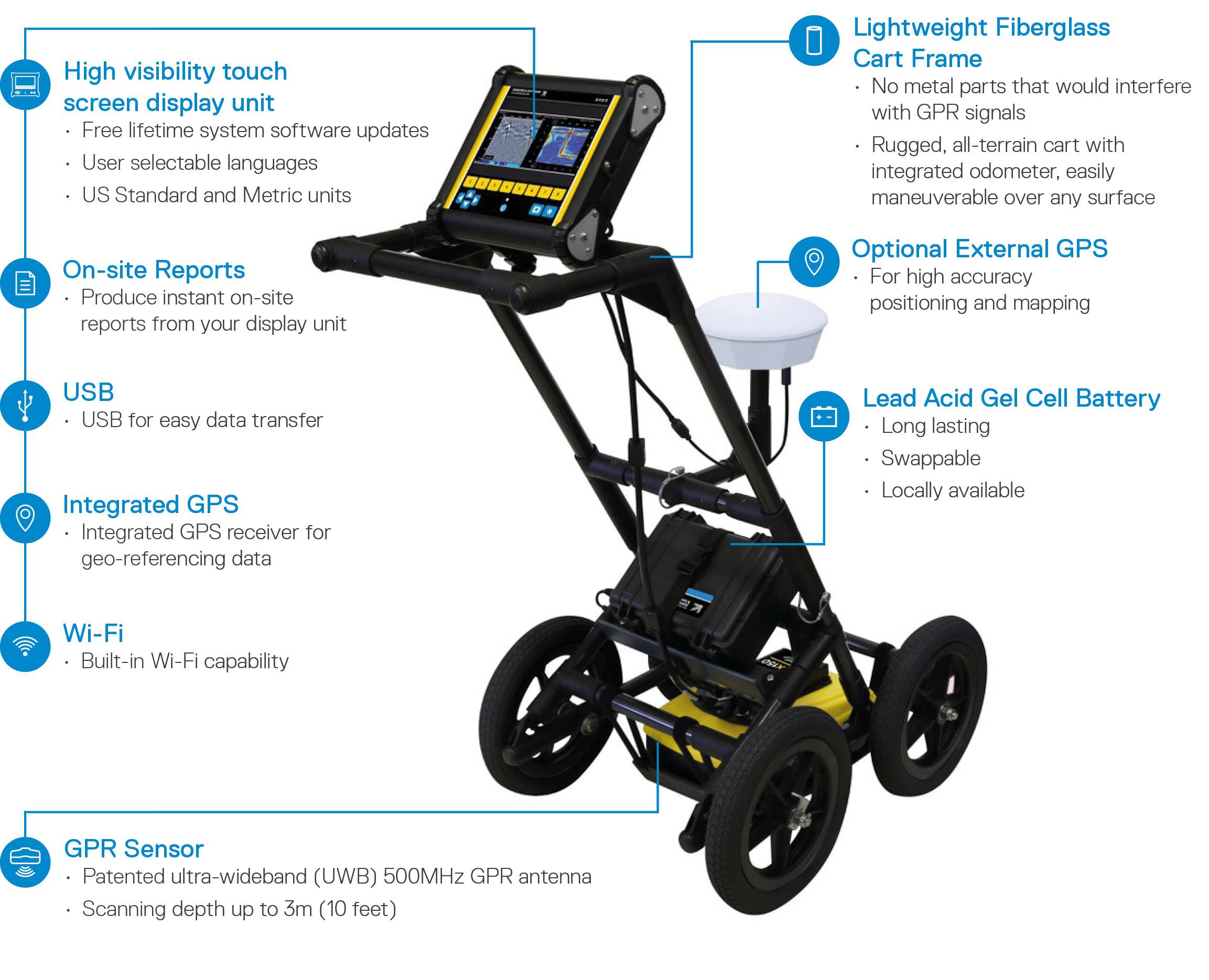
LMX150™ FINDAR® uses ground penetrating radar (GPR) technology to enable law enforcement to quickly and effectively search for evidence buried under the ground.


The advantage of GPR compared to other commonly-used subsurface search technologies, such as metal detectors, is its ability to detect both metallic and non-metallic objects. LMX150™ FINDAR® can locate:

  • Clandestine graves
  • Drugs or money buried in metal or plastic containers
  • Buried weapons and ammunition stashes

Benefits of LMX150™ FINDAR®

  • Locate evidence in real time
  • Convenient and intuitive to use with minimal training
  • Locate buried evidence on a variety of terrains and make decisions on-site.
  • The intuitive user interface guides investigators through a systematic grid search
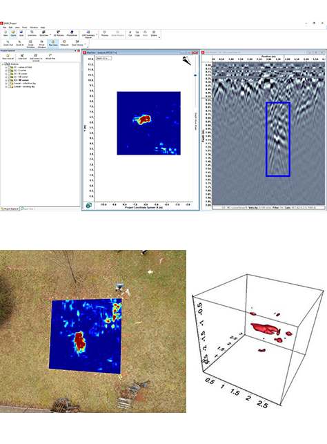
  • Generate 3D images on-site in seconds pinpointing the position and depth of potential evidence
  • Compact and portable system that fits into a single hand-carried shipping case.
  • Transfer screenshot images to a PC and integrate images into your reports.
  • Export GPR data to a PC to post process in the optional EKKO_Project™ Software to visualize, understand and report your findings.

 

GPR data line mode radar
Line Mode
Collect cross-sectional lines for reconnaissance purposes. Identify and focus your search on relevant areas
ground radar grid
Grid Mode
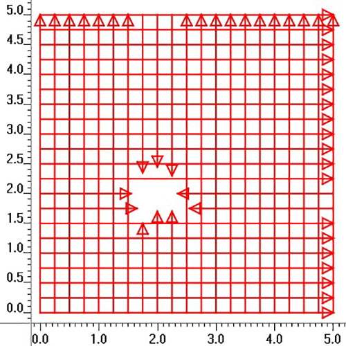
For detailed survey over areas of interest, collect grids. Easily collect lines around obstacles within the grid.
deep buried depth radar slicing
3D Depth Slicing
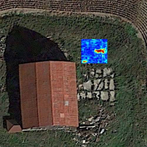
After collecting a grid of data, generate depth slice images on-site. Quickly pinpoint the position and depth of potential targets.
adding interpretation to map on gpr
Field Interpretations
Classify targets in real time with field interpretations. Use the touchscreen to color-code each target as it is located.
map view for radar
Map View
Using the optional external GPS, Line scans, grids and field interpretations are displayed on the screen in a plan map view.
radar screenshots
Screenshots
At any point during the survey, save screen captures of line data, map views and depth slices as graphic images.
geo referenced gpr
Geo-referenced Output
Using the optional EKKO_Project™ PC software, display your survey lines, depth slices and interpretations in Google Earth™ and other similar geo-referenced platforms.
usb data transfer port
USB Data Transfer
Transfer screenshot images and access the GPR data for further post processing in the optional EKKO_ProjectTM software.
EKKO_PROJECT™ PC software

Visualize, Understand and Report your GPR results with optional EKKO_Project™ PC Software

ekko_project software

    GPR data exported from the LMX150™ FINDAR® system can be post-processed in our all-inclusive EKKO_Project™ GPR software for managing, displaying, processing and interpreting GPR data.

    With intuitive data visualization tools, you can view your data from different perspectives to gain a deeper understanding, and then quickly and easily produce impressive reports to share your findings.

    EKKO_Project™ and its bundles allows you to:

  • Organize GPR data, photos and other files as a single project (.GPZ file)
  • Easily create PDF GPR summary reports of your findings.
  • Add interpretations, photos, audio & video to GPR lines.
  • Create depth slices with or without a grid.

Explore the many options for data visualizations and analysis with EKKO_Project software bundles.

Learn More

Contact Us

Lease to Own option available

Case Studies

Two people using FINDAR in field

Murder in Sweden - GPR Guides Evidence Search

After years of police investigations, it was Ground Penetrating Radar (GPR) from Sensors & Software that helped solve the mystery of missing females whereabouts.

Learn more

Leasing Options Now Available!

Contact us today to learn how you can get unbeatable lease options on our full range of Ground Penetrating Radar equipment with low monthly payments!