


he Forensic Osteology Research Station (FOREST) is part of the Forensic Anthropology Program within the Anthropology and Sociology Department at Western Carolina University. The facility, the second oldest in the United States, was first established in 2005 and is used for the education of medicolegal professionals, implementation of various research projects in forensic anthropology and also as a service to provide consultation, training, and outreach to the law enforcement and medicolegal communities.
Background
Prior to the establishment of these facilities, animals such as pigs and rabbits were used as proxies for humans but recently researchers have demonstrated that non-human models like pigs do not follow the same decomposition patterns as humans. At this facility, donated human bodies have been buried at different depths over a period of time and are therefore at different stages of decomposition.
Sensors & Software was invited to survey the site with ground penetrating radar (GPR). We brought our FINDAR® GPR system to gather data and provide students in the Forensic Anthropology Program some practical experience with GPR in the field.
Survey Area
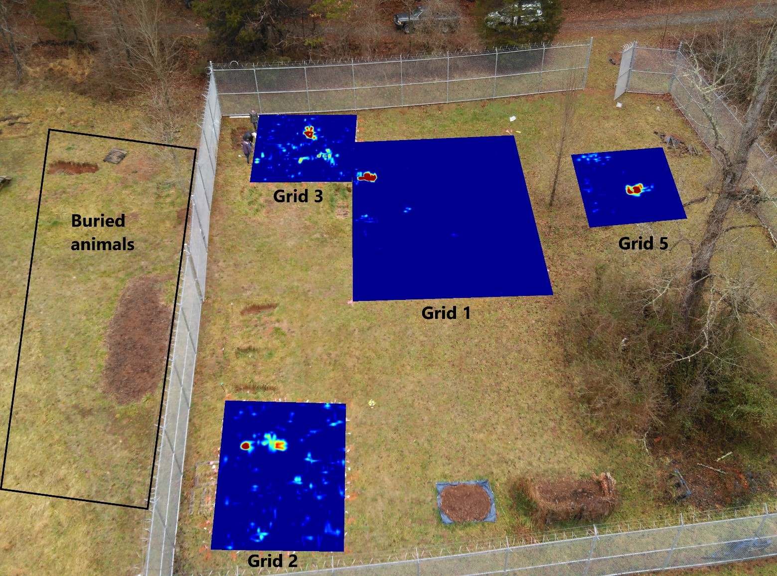
The survey area was 30.2 x 30.2 m, on a 15-18 degree slope and encircled by a very tall fence. There were four areas with bodies that were selected to be surveyed (Figure 1).
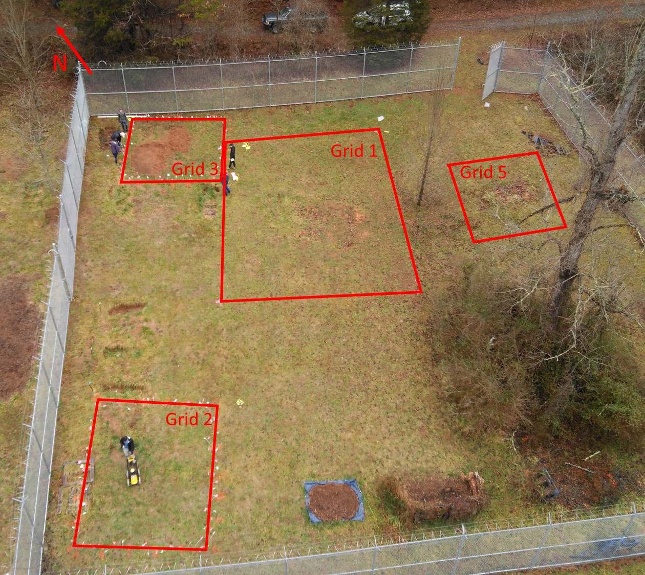
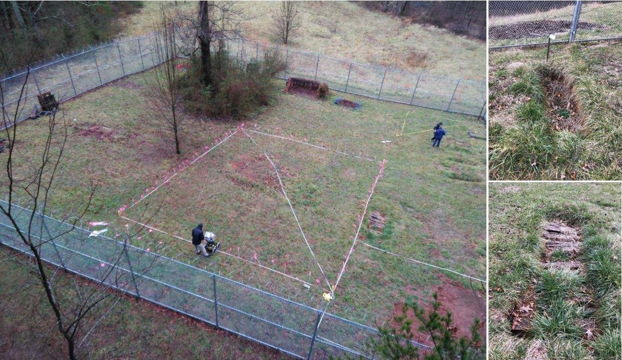
The grid locations were limited by trees, and up to one-foot drops where the ground above the buried bodies had either sunk or the burials were only covered with wooden pallets (Figure 2). Instead of doing one large grid, the area was broken into 4 sub-areas covered by one grid 10 x 13 meters in size and three smaller girds (one 5 x 6 m, and two 6 x 6 m). The rationale was to focus the survey on areas where there were known bodies, to avoid obstacles like depressed graves, trees, and wooden crates and to have complete grids in case we had to stop the survey due to inclement weather. The fourth grid is referred to as Grid 5 as Grid 4 was collected over the same area but was incomplete.
Data collection
FINDAR® is a great teaching tool when introducing people to GPR; with an intuitive interface that guides you through grid setup (Figure 3).

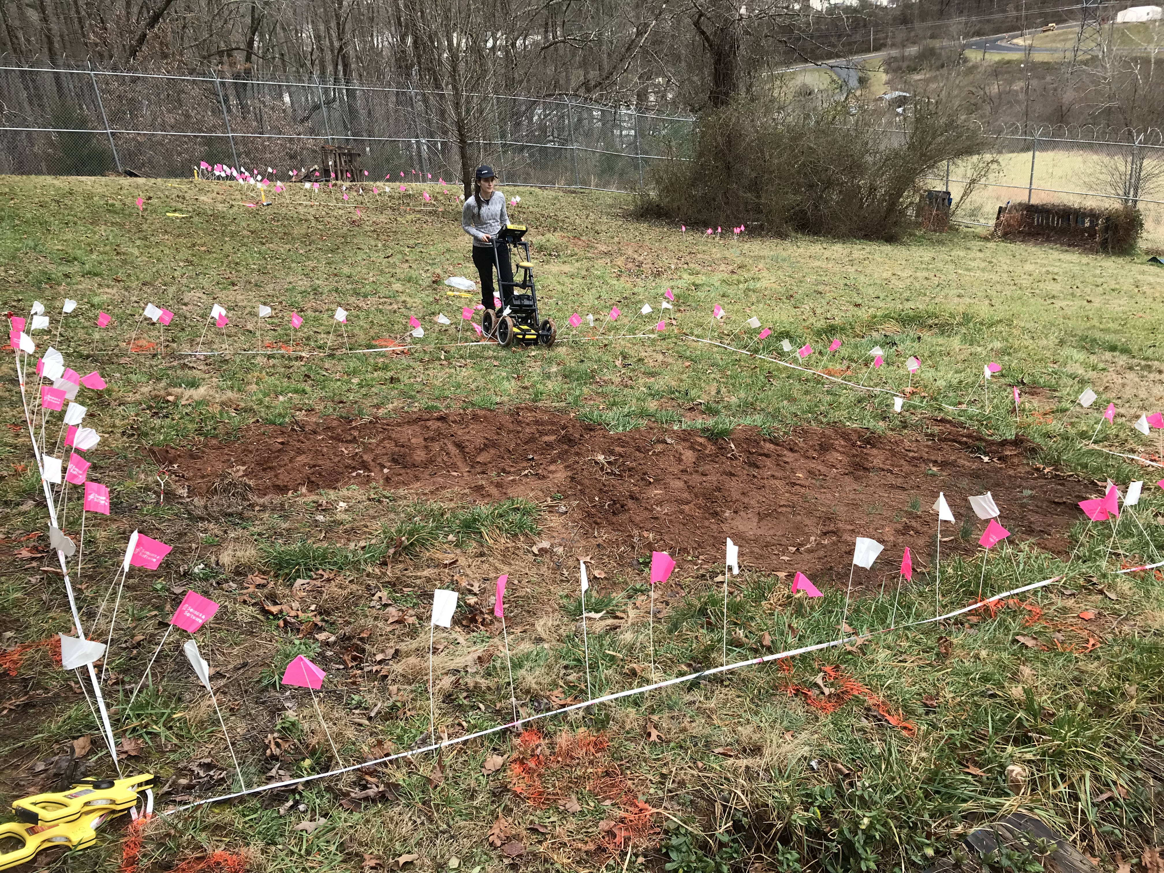
Grids were laid out using two tape measures each and were marked using paint at 1 m intervals and alternating colored flags at 0.25 m intervals (Figure 4).
Results
GPR data obtained from the FINDAR® proved valuable in pinpointing the location of the buried bodies. A depth slice of Grid 2 showed a body buried in February 2017 at approximately 40 cm, which was verified by using a ground probe (Figure 5; left).
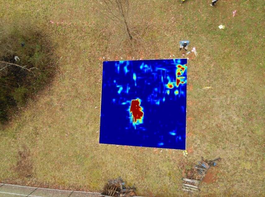
For Grid 3, a depth slice at around 40 cm overlaid on an aerial view of the top left corner of the survey area that covered two know burials done in 2017 and 2019, only shows one anomaly (Figure 5; right). This was attributed to heavy clay soil on top of the second body, resulting in strong GPR signal attenuation (Figure 4).

3D Preview, a feature in EKKO_Project™, allowed an anomaly observed in the depth slice of Grid 3 to be seen alongside the two perpendicular cross-section lines, providing a better interpretation (Figure 6).

FINDAR® was also successful in locating the position and depth of the body buried in September 2016, found in Grid 5 (Figure 7).
Conclusion
FINDAR® successfully showed that GPR is a great tool to provide the location and depth of donated bodies that were buried over the years at a human decomposition facility (Figure 8). The results obtained also demonstrate how adding GPR subsurface imaging technology as part of a forensic anthropology curriculum could benefit students.
Acknowledgments
We would like to thank Dr. Katie Zejdlik and Western Carolina University for allowing us access to the FOREST facility as well as the students for coming out to assist us with the survey despite the inclement weather.


